Our long passage home began on Monday, so this is Day 5, and it has gone better than I expected. I’ll never be a sailor, but Bob sure is. If you ever have to go on a long voyage against your will, I highly recommend Bob as your captain and Chris Parker as your weather router. You cannot do better!
Day 1: (Monday, May 4) We left Caneel Bay, St. John, at 1pm. We were wallowing a bit in following seas with the wind directly behind us. I got out my sketch book/notebook to jot down a few impressions of each day, and on this day I noted that I was having a hard time writing. I was worried that writing would make me seasick, so I kept it rather short. By 5pm we had left the Virgin Islands behind us. By 10pm we could lights on Culebra and we could see Puerto Rico faintly in the distance. There were big swaths of sargasso everywhere, and a big clump of it was tangled on the rudder of our windvane. There were big, dark squall clouds all around us, and from 2am – 5am we sailed through a number of them. Seeing big squall formations on radar was was intimidating for me. We also saw one ship in the dead of night. My anxiety level was high. I was no help at standing watch since I kept falling asleep–a sure sign of mild seasickness!
Day 2: (Tuesday, May 5) Low wind, wallowing in following seas. I was looking forward to seeing Puerto Rico, but during the day I could not see any of it. Our course took us from about 25 miles off the coast to 40 miles off the coast. During the morning we sailed over the deepest part of the Atlantic Ocean, the Puerto Rico Trench. It’s over 27,000 feet deep there, which is more than 5 miles deep. Just a bit further west is the Old Bahamas Channel that has some of the shallowest shoals I’d ever imagine to find in the middle of the ocean. What a strange world! Our view was 360 degrees of water. It is a deep indigo color verging on purple, like what we see all through the deep waters of the Caribbean. When night fell we had non-stop squalls, especially from midnight ’til 8am. I slept through most of this, leaving all the work to Bob for a second night in a row.
Day 3: (Wednesday, May 6) Squalls. Uncomfortable! Are they ever going to stop? On the one hand, the winds have been light, and seas are down. I told Chris Parker I wanted a flat sail home. I wanted to feel like we were just sailing across a lake. He’s done a great job of finding those conditions for us. If only the squalls would stop! Bob has always said that he finds Day 2 of a passage to be the hardest. On Day 2 he often wonders how he will endure the entire trip. For me, that day came today, on Day 3. I struggled with a sense of feeling imprisoned in a small space with a view of a vast seascape which was not at all soothing. The Dominican Republic was to our left, but we could not see it, even at night. I was fairly depressed this day, unable to pass the time reading or knitting. I have a few audio books, and it was helpful to recline in one of our adjustable cockpit chairs with my eyes closed, listening.
During the night we had a parade of ships, likely due to being in the vicinity of the Mona Passage and Windward Passage. I don’t know why I hardly ever see a ship during the day; then they all seem to pass by us during the night. It’s stressful. On the positive side, I was able to stand a 2-hour watch so that Bob could sleep. Progress!
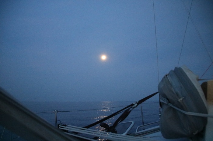
We are traveling during the time of a full moon, which does make for a a few moments of excitement in that otherwise endless view of water and more water. The nights have been overcast due to the squally weather, but the moon has been a lovely gem.
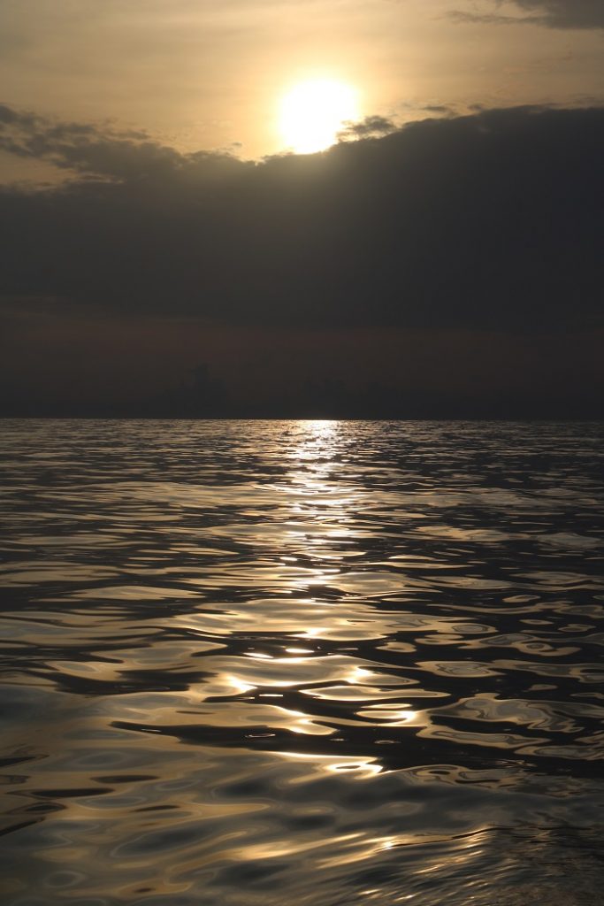
Here is the moon setting, no longer silver but a stunning golden orb from the rising sun.
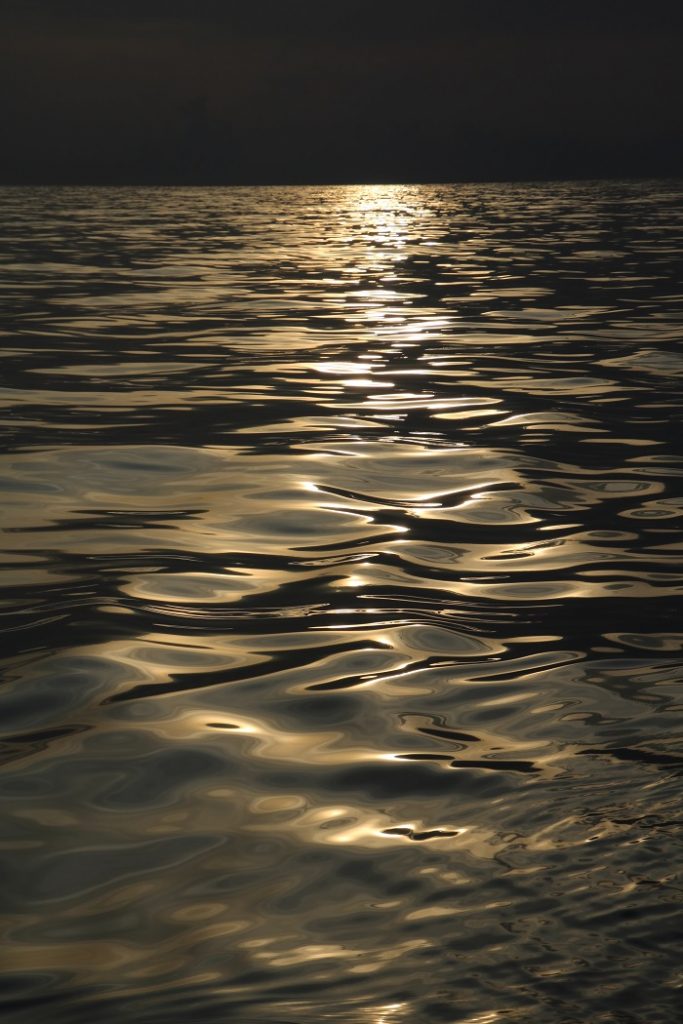
The water in the foreground is a perfect study in calm seas. Bob took a close up for me.
Day 4: (Thursday, May 7) We’ve now gone more than 350 miles. There has been no sight of land, which is rather depressing. I had hoped to see some of the Dominican Republic, and maybe even a bit of Haiti. Still following winds directly behind us, but calmer seas so that we are not wallowing today. I can read!– and I actually spent a good deal of the day knitting!
We learned that bad weather is headed our way. A cold front is forming that will bring near tropical storm weather right to our route home. Our weather router is urging everyone in our flotilla to get shelter on the southernmost island in the Bahamas, Great Inagua. The Bahamas is closed to boating traffic at the moment, even for boats seeking shelter, so our shoreside volunteers in the Salty Dawg organization did some terrific work in getting our homeward bound flotilla boats permission to land at Matthew Town on Great Inagua for as many days as we need to avoid the bad weather. We cannot check in to the Bahamas, or go ashore, but we can anchor and wait out the storm. We could not have managed this individually, so help from these volunteers is priceless. They are working hard to get us safely home. What a relief.
The night was challenging for me. There were squalls all around us with violent lightning on both sides of the boat. I stood two watches this evening, so Bob got more sleep than he’s had in three days. It was frightful to me. Like desert mirages and visions in the fog, after a while I began to see things in the haze. The radar showed that there were two boats that would soon cross our paths, all of us headed to shelter in Great Inagua. As hard as I looked into the gloaming to find their running lights, I could not see them. I saw all kinds of other things instead! I saw various ships and strange lights, and I heard ominous sounds. After 3 1/2 hours, I could not stand the stress any longer, so I woke Bob to take my place.
Today is Day 5. (Friday, May 8) We have sailed 537 miles, which is close to half the way to Florida. This has now become the longest passage I have made. It’s seems like a great time to take a break, but this is not the break I’d like to have. There are no harbors on Great Inagua; boats simply pull up to the shoreline and anchor. The Bahamas is notorious for ‘clocking’ winds, which means that every few days the wind direction shifts around the entire compass. We arrived here with westerly winds which is the worst direction for anchoring here, as you’ll see on the map. In westerly winds this is called anchoring on a lee shore, which means if your anchor drags you’ll drift right onto a shore that will be a challenge to get off since the wind is pinning you on that lee shore. Not good! The winds are slowly shifting eastward, but the westerly ocean swell will continue to roll us about. We are now facing northeast, with northwest waves rocking us sideways. It will be hard to sleep tonight. As I often say about sailing, “out of the fire and into the frying pan.” I wish this weren’t always the case.
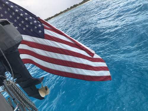
And here we are newly anchored off Matthew Town on Great Inagua. This is the memorable Bahamian blue one finds in about 20 feet of water. Stunning.
We have been granted permission to anchor in either Matthew Town, where we currently are, or in Man of War Bay, just north of Matthew Town. You can see neither of these locations is protected. The wind is gradually shifting to the east, but the waves continue rolling in from the west. It feels just like our first two days of wallowing in following seas. Ugh.
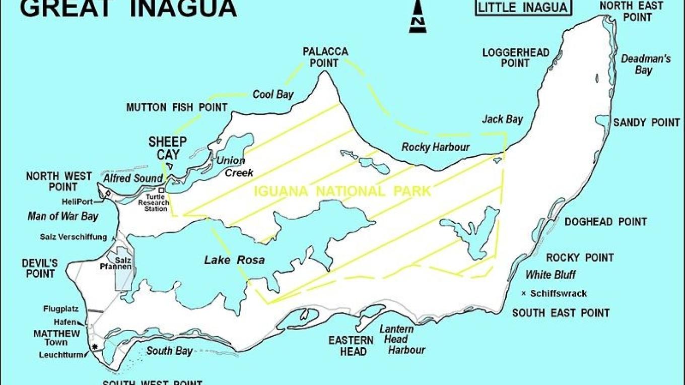
We cannot go ashore here, but I should mention that there is a big salt pond on the island, where Morton Salt makes their sea salt. On the map you can see this salt pond right at the lower left hand corner, just inland of South Bay. There is a gate that can be opened to flood the pond with sea water. Then the tropical sun causes the water to evaporate and leaves behind the salt. It’s terrifically hot here. I can imagine turning into a block of salt myself. I am so ready for some temperate New England weather!
There is also a protected flamingo rookery here. We won’t be seeing any flamingos on this visit, since we cannot go ashore. I guess I’m happy to be here. It’s uncomfortable, but it has to be better than riding out a tropical storm.

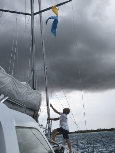
I’ll close with this photo of Sailor Bob, ever ready to take on a long journey and make the best of whatever conditions Mother Nature throws at him. He’s hoisting the “Q” flag (for quarantine) and the giant Salty Dawg rally banner. Do you see that threatening black cloud above us? That’s another squall in the making. Bob is not worried about it. He set the anchor well and now intends to open a cold beer and get some well deserved R&R. As he sat down to enjoy himself, he got a wonderful air show of a US Coast Guard helicopter landing on the airstrip in Matthew Town. I was so tempted to hail them on the radio and ask for a ride home!
.
You are in my thoughts. One day at a time. Hopefully Bob can rest. Maureen
What a great informative blog post. We have been watching and worrying about you. I can’t believe how calm the sea was for you in that picture. (We didn’t have that) but I’m so glad that you got comfortable, if only for two days. Tell Bob that Mark says not to forget about a stern anchor while you are in Great Iguana.
Hugs
So happy for the update. Sorry the anchorage is not as calm as you’d like, but I’m glad Bob will be able to get some rest in preparation for the second half of this voyage.
So happy to read that you were not incapacitated with seasickness and were able to help Bob. Hope you are able to safely ride out the storm and start on the last leg.
Boy, did Bob need rest. It turns out I’m not much help!
Brenda,
We’re following you all the way. Thanks for the reports. It’s really good to hear from you. Almost makes me feel like I’m there – and certainly reinforces my lack of desire to go on an offshore passage. Very glad you’ve gotten to shelter even if it’s not the most comfortable anchorage.
Stay safe,
Beth
So glad to hear that you are at anchor, even if not in the most optimal conditions so that hopefully, both of you will get some much needed rest.
Many thanks for thinking of us!
We have been following your trip and wish you well. If you can think of any way John can get to you and help sail please let me know.
Wow! Halfway to Florida. Yes! You are doing this.
Happy to hear you are on your way. Reading your words makes me feel as if I was with you. Be safe. You will be home soon.
Thank you, Sue. It means so much to me to know that you were following me.
So beautifully written and photographed…if only this were a work of fiction. Safe sails my friends!
Thank you, dear friend!
Bob, watching your progress daily. Enjoy, stay safe. Bob
Getting close to home! YES!
So glad to hear you have made it so far and are safe from storm and disease. I cannot imagine the stress and anxiety of such a trip. You will feel soooooooo good when you arrive home! Bon voyage.
It’s true, Rhoda. I feel great to be home. I need to stay here longer this year.
I felt like I was with you. Really great description of conditions….have sailed a bit and do really empathize with your discomfort. Safe passage to you.
Thank you for following my trip, Frances!